Two Borders in One Day: Tsak Kar Lake at 3,270 Metres and Meghri on the Araks
Garo Kotchounian13 min readMeghri
In this article (11)
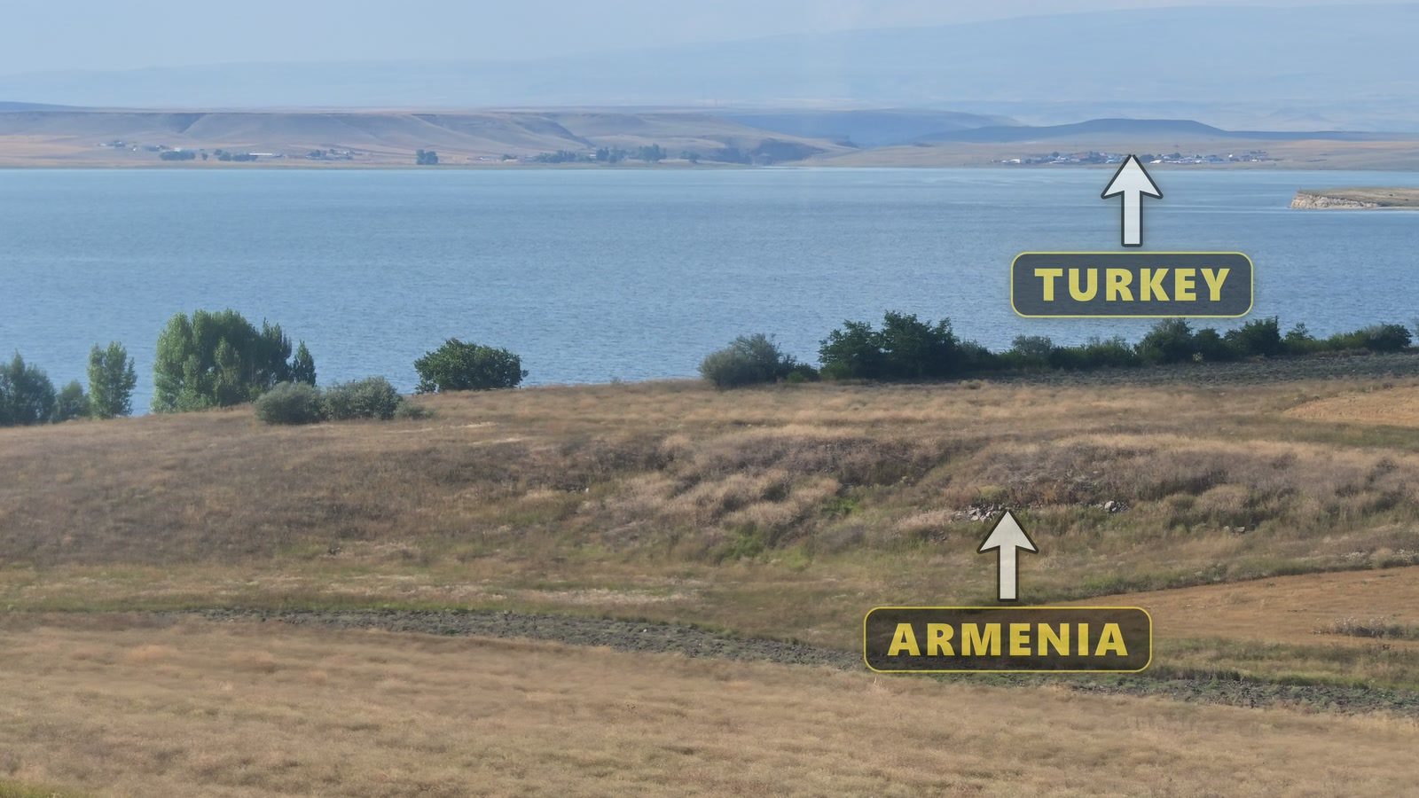
The night before, by the river in Kapan, I had told the camera the plan: a lake towards the Nakhichevan side, with snow even in August, and then a taxi to Meghri. The lake I reached was not the one I had planned, and I forgot its name ten times before lunch. By nightfall I had stood beside two borders: one that you cannot see, behind the snow, and one that you can, across a river.
It was Tuesday, the eighteenth of August, the day after the climb up Khustup at three in the morning.
The other lake

The plan had been Lake Gogi, Kaputan on the maps, which lies right under the crest that marks the border. The day before, Harut, the same guide who had taken me up Khustup, had to register his car’s number plate and our group with the border authorities, because the lakes lie in a border zone. The answer was no to Gogi and yes to Tsak Kar, about two kilometres short of it. Up the track there was a checkpoint, manned by Armenian lads, and the soldiers had no need to talk to us.
Past Kajaran, the copper town, the tarmac gives up and the four-by-four starts to climb. I rode in the open back with the camera, laughing most of the way. There used to be a mountain here, Harut said from the wheel; now it has come down and is sliding into the river.

On a high cliff stands a huge rock with a hole right through the middle. I filmed it from below, so I cannot tell you how wide the hole is, only that it is enormous. It is the reason for the lake’s name, and it took me half the day to hold on to that name. Higher up there was snow on the peaks, with waterfalls running beneath it, in August.


The lake
A little before one o’clock it appeared: a small turquoise lake with ice still in it and snow above it. My phone read 3,274 metres, the highest point it recorded on the whole trip. I told the camera that I would now tell you the name of the lake, and then I did not.

I stuck the camera to the roof of the car with a magnet and let it turn, taking in the lake, the snow, the mountains and a small figure with a raised hand, which was me. I said that I was not the important one in this video, and that what mattered was the place itself, which was the border: behind me, up there, lay Nakhichevan.
I had already asked Harut to say where we were. “This is Tsak Kar lake,” he said. “It lies at the foot of the Zangezur ridge, at three thousand two hundred and seventy metres; we are seventy metres higher than Khustup now. The snow has not melted here yet, and there is still ice in the lake.” The lake covers about three hectares, some ten kilometres south-west of Kajaran, and hikers find ice on it even in July. Thank you, Harut jan, for this tour.

There were eleven of us, counting the driver. The lake is an hour and a half or two hours from Kapan, and we came up in a special car with a special driver, because getting up here in a private car is hard, if not impossible. Go with a guide, and he will tell you on which day the weather is good. Two young women from Buenos Aires, in Argentina, had already gone into the water for a swim. Whether that is a clever thing or a crazy thing I do not know, but if you like crazy things, come too.
The name
Tsak Kar means the holey stone: tsak is a hole and kar is a stone, and the stone is the rock with the hole on the way up. When I had explained this to the camera by the water, I added that beyond the peaks and the snows lies Nakhichevan, in the Turks’ hands now. The state list of natural monuments spells the name Tsaghkari, but the people who go there write Tsak Kar, and so do I.
The wreck
The wind by the water was cold enough to talk about. Look behind me, I told the camera, because the two women from Buenos Aires had already been in for their swim.
Further along, by the stream, lay something made of metal, and I asked what it was. It was part of an aircraft, Harut said: a plane was brought down in the war, and a piece of its wing is up on the mountain, and its engines too. I wondered aloud whether the engines had fallen into the stream. That account of the aircraft is what I was told, and it is what the film says. Afterwards I looked for a record and found nothing documented, neither the type nor the date nor any report of a crash by this lake. I believe it is from the 2020 war.

Then I admitted to the lens that they had told me the lake’s name ten times, that I had asked it myself as well, and that ten times I had forgotten it. So at lunch, with bread on the grass, I went to ask the people who had not forgotten. “People, where are we?” I asked. “We are at Tsak Kar lake, Garo jan,” they said. “How high is it here?” “Three thousand two hundred and seventy metres.” There are clever ones among us too, someone said; they had said they would go for a swim.
Victoria and Chechu
By then the swimmers had dried off, and they were, as I had guessed from hearing one of them speak Armenian, ours. “Chechu, and she is Vicky,” said the one who speaks Armenian. Both are from Buenos Aires, and both went to the Armenian school there. Vicky speaks very little Armenian, so we went on in English. Her first visit to Armenia was with the scouts, and the next year she came with the school on its graduation trip, fifteen years ago. I told her that this revealed her age, and she answered that they were old. This time she had come back on her own, not with a group, for a month and a week, to rediscover the country. When I asked what had changed, she spoke of growth, especially in Yerevan, but what impressed her most was the road. Fifteen years ago it was in very poor shape, and now it is brand new, so that you can get close to places like this one, which are quite hidden.

Chechu moved to Armenia six and a half years ago and lives in Argel, a village forty minutes north of Yerevan. They had come south in her Subaru, and when the road became too rough they parked and walked the last four kilometres, all of it uphill, and then went into the ice water. She is the driver and the guide, she said, and indeed she is: she runs Chechu Armenia, which offers private tours for Spanish-speaking travellers in Armenia, and its links are at the end of this article.
They asked about me in turn. Yes, there is an Armenian community in Cyprus, I told them, and we speak Armenian all the way. I grew up in Beirut, in Bourj Hammoud, which everybody knows as the capital of the Armenians, and my parents are still there. We talked about Anjar, which Vicky had visited, and its Cross Day, which is held twice, once for the people of Anjar and the following weekend for the visitors from Beirut. Chechu’s favourite place, she told me, is a bridge that I had passed without going down to it, because reaching it takes a rope and a scramble. Not for me, I said; I am not a rope guy. We talked, too, about Khustup at three in the morning with the same guide, and about the fox. Their lunch was potatoes cooked the day before, with vegetables and herbs. When I asked whether they were vegans, Chechu said that they were vegetarians.
Down, and over the pass
On the way down, one of the group asked Harut whether he had ever climbed up to the holey stone, and he said that he had. Was it very frightening? It was, he said. Could we walk it? You put your foot here and your foot there, he said, and the weather has to be dry. Further down we passed a frog on a rock, and then we reached the tarmac at the highest point of the road from Kapan to Iran, the Meghri Pass, at 2,535 metres. From there the road goes down and down into the valley of the Araks.


When the group turned back for Kapan, a taxi took me on to Meghri. Japanese and European cars go from here to Iran, the driver told me, and Chinese cars come in from Iran, so there is still a kind of business. Meghri’s autumn is very beautiful, he said as we came into town, the autumn that the school books describe.
Meghri sits at about 600 metres, facing Iran across the Araks, 376 kilometres south of Yerevan, at the far end of the country. It was founded in 906, and its name, they say, comes from meghr, honey. It is the hottest place in Armenia, and the national record of 43.7 degrees was set here in the summer of 2011. On the day of my visit it was thirty-five degrees, and there were pomegranates, figs and persimmons in the gardens. The town has two old quarters, Mets Tagh and Pokr Tagh, the big quarter and the little one; in Pokr Tagh the houses climb the slope in terraces, and the roof of one house is the terrace of the next. From the taxi I called out a greeting to people eating outside as we passed, and wished them a good meal. Then I walked up the cobbled lanes to find the church on the hill.
The church on the hill, and a candle
At first I did not know which church it was, and I said so. It stands above the old town at the top of a flight of steps, and from the steps the whole town lies open. The air was quite different from that morning’s air at more than three thousand metres, among the snow, and the wind was very strong. Look how beautiful this is, I said.
Inside there is a place to light candles, and someone has even put out matches. Come, I said to the camera, let us light a candle together and say a prayer. I made sure that it had caught, and then I recited the Lord’s Prayer to the camera, so that you could say it with me, and ended with Amen. To whoever among you is ill, or in any other trouble, I said, I hope this prayer reaches you too, and I wished you happiness.

The walls and vaults are covered in paintings. By the door a plaque gives the church both of its names: Surb Hovhannes, the name I said on camera, and Surb Sargis, the name under which the state’s list of monuments records this seventeenth-century church of Pokr Tagh. The plaque also states that the church was preserved and its frescoes restored between 2016 and 2019 with funding from the United States Embassy.


The Araks
That flag over there, the driver said on the road out of town, is the border. My phone read 575 metres; that morning it had read 3,274. Above the river is a place made for looking, with a gate, a path between cypresses and a platform with flags. It is Grandpa Zhora’s garden. Zhora Sargsyan, a man of Meghri, worked for more than forty-five years in St Petersburg and came home in 2011. He cleared the rubble from the high bank, had soil brought in and planted figs, pomegranates, persimmons, peaches and kiwis, so that anyone could stand here and look across at Iran, and tens of thousands of people have done so.

Dear ones, I said, I am on the border between Armenia and Iran now. This is the Araks, and behind it the hills and the mountains are all Iran; where those cars are driving is already Iranian land. The border runs for forty-four kilometres along this river, and its only crossing is at Agarak, nine kilometres to the south-west. The day before, at Halidzor, Aram had told me that the water from Kapan goes down to the Araks, and this is where it arrives. You could watch this place for days and never have your fill of it, especially of the sound of the water. You probably could not hear it, I said, because the camera’s noise cancellation is no good in a place like this. It was my first time in Meghri and at the southern border.

Surb Astvatsatsin, a town of fruit, and a ruin
Back in town there was a second church, and this time I asked the people outside its name. Surb Astvatsatsin, they said. It is the church of the Holy Mother of God of Mets Tagh, built in 1673 and painted inside in the nineteenth century. There was a fountain, and I drank from it, because the water from these fountains is good.

Someone had told me a name, Anapastanats monastery, I think, and I went looking for it through the gardens. There were trees of every kind everywhere, for this is a town of fruit, and when I could not tell whether one of them was an apple tree, I said again that we are the supermarket generation. What I was looking for, I learned later, was the Meghri monastery, which is also dedicated to Surb Hovhannes and was built in the seventeenth century, with frescoes of 1745 and 1793 and its old western hall half collapsed. I came down below it by the wrong route, and building work and scattered stones left no way through.
So I crossed over on the walls into a ruin with an altar, about a hundred and sixty metres from the monastery and perhaps once part of it. Passages led up and down, and God knows where they go; I thought of the people who lived here for years and of the things they built. Then, with a count of three and a jump, I was out. Afterwards I asked the camera to remind me of the church’s name so that I would not forget it, because I have, I think, the memory of a fish.
Thirty-five to nineteen
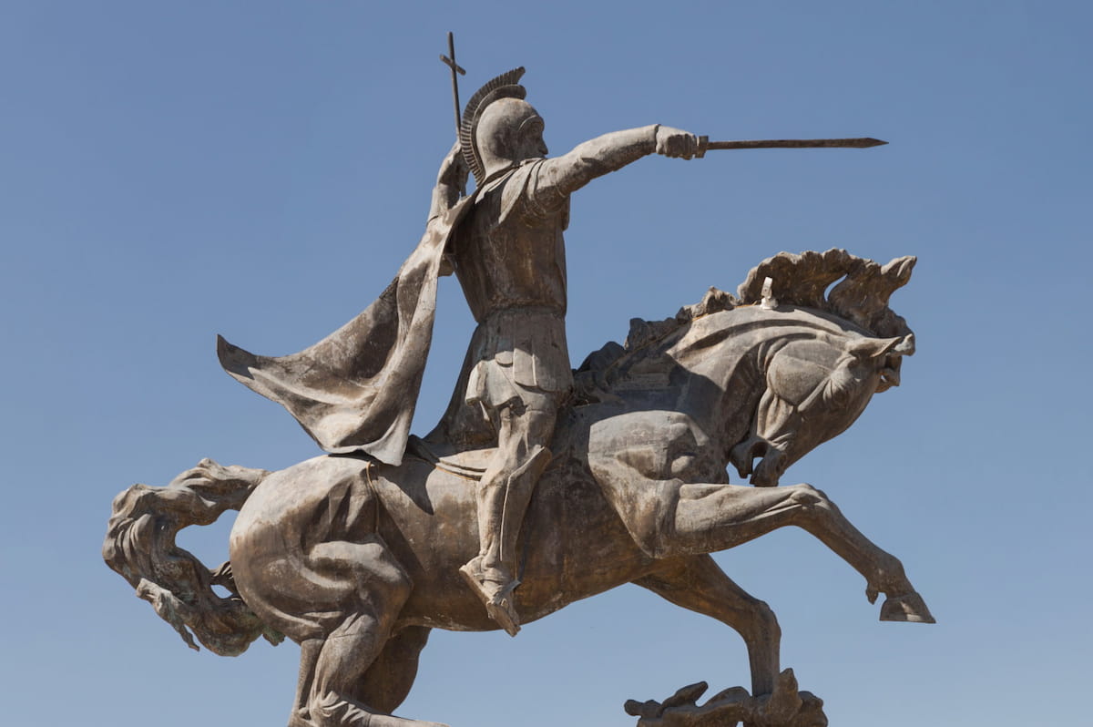
The road north ran through the evening light, past horses at the roadside, with the sun shining straight through the windscreen. Meghri had been thirty-five degrees, the driver said as the car climbed, and here it was nineteen. Nineteen degrees, I said; what a difference! The town was Kajaran, at 1,950 metres; its combine produces, by its own count, about two per cent of the world’s molybdenum. I asked you on camera whether you had seen the statue of the bear. On a rock above the Voghji, on the road between Kajaran and Kapan, a bear holds a bronze key in its mouth: this is Kajaran’s Key, by Marat Nurijanyan, who also made the David Bek monument in Kapan with Sargis Baghdasaryan. He began the bear in 1966, and the key was added in the 1970s; it is, as the story goes, the key to the treasures of these mountains, which here means their copper and molybdenum. Then came the gorge, the light went, and I was back in Kapan and in bed.


What I understood
I stood beside two borders in one day. The one at the top I could not see: there was snow and a crest, and behind them Nakhichevan, which everyone could point to and nobody could show me. The one at the bottom I could watch, with cars driving along its far side. Between them came a name I forgot ten times and will not forget again, two Armenians from the other end of the world in the ice water, a piece of a war that nobody has written down, a candle for whoever is ill, and a garden planted on the border so that people could stand and look. You go for one lake, and you are given another.
The lake trip was with Harut, of Khustup Hiking and Jeeping Tour in Kapan, the same guide as the day before. He is on Instagram as @khustup_hiking_jeeping_tour. Ask him about the lake.
Chechu runs Chechu Armenia, which offers private tours, personalised itineraries and digital travel guides for Spanish-speaking travellers in Armenia. She is on Instagram as @chechu.armenia, and her website is chechuarmenia.com.
In the next article, I travel from Kapan back north, to Yerevan and on to Gyumri.